
Yosemite National Park Photos and Videos
All photos and videos on this page were taken by the Berg and Wilson families.
For more information on Yosemite visit the National Park Service website here
For interesting articles about Yosemite and the surrounding areas click here

Half Dome
June 2008 - Photo taken from the path to Glacier Point. Glacier Point is a viewpoint located on the south wall of Yosemite Valley at an elevation of 7,214 feet (2198 m) and 3,200 feet above the valley floor (975 m). There are a number of trails that can be found off of Glacier Point road.

Yosemite Falls
June 2017 - Yosemite Falls Upper and Lower viewed from Glacier Point
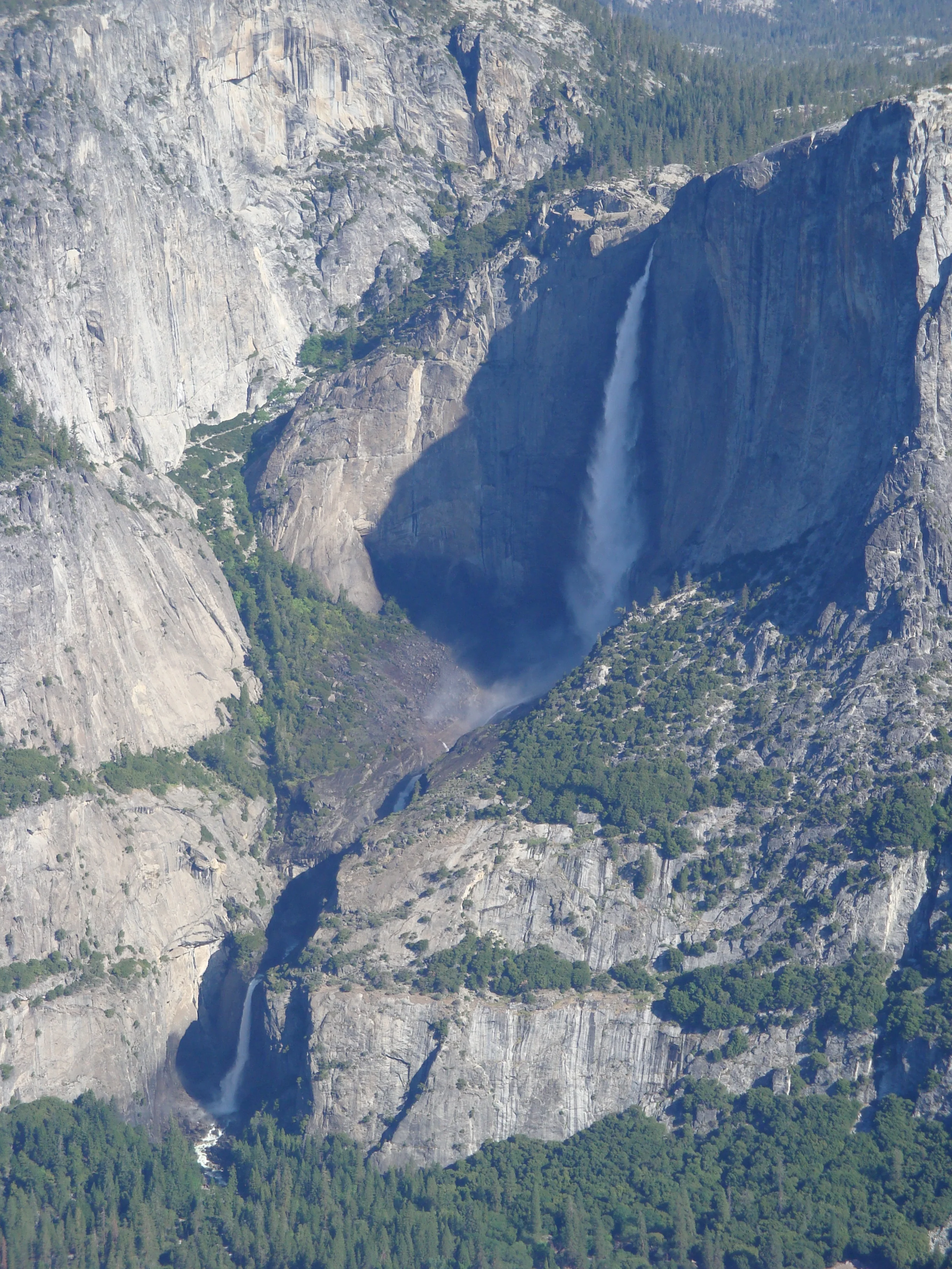
Yosemite Falls
June 2008 - The same view of Yosemite falls taken from Glacier Point with a telephoto lens.

North Dome and Basket Dome
June 2008 - North Dome (left) and Basket Dome (right) as viewed from Glacier Point

Half Dome and Clouds Rest
June 2008 - Another view of Half Dome from Glacier Point. Behind Half Dome is Clouds Rest. In my opinion, the best views of Half Dome are from this vantage point and from the Panorama Trail.

Half Dome
June 2008 - This view of Half Dome is taken from Panorama trail. The Panorama Trail follows the southeastern portion of the valley rim crossing Illilouette Creek at the top of Illilouette Fall to the sunny flat where Nevada Fall launches itself over the cliff into Yosemite Valley. The Giant Staircase is in sight much of the way, as well as occasional glimpses of Yosemite Falls back to the west. You are able to see five famous waterfalls all in one hike.

Illilouette Fall
June 2008 - A view of Illilouette Fall from the Panorama Trail. Note the shape of the rock formation on the right.
Illilouette Creek
June 2017 - Illilouette Creek just before the fall. Video taken from the Panorama Trail.

Illilouette Fall
June 2017 - Illilouette Creek fall. This fall is difficult see up close unless you step off the trail and only if you take the Panorama Trail. Photo taken from the Panorama Trail.
Illilouette Fall
June 2008 - Illilouette Fall as viewed from the Mist Trail.

Nevada Fall, Liberty Cap and Vernal Fall
June 2008 - Nevada Fall, Liberty Cap, and Vernal Fall as seen from Glacier Point.

Liberty Cap
June 2008 - View of Liberty Cap from near the top of Nevada Fall.
Merced River
June 2017 - Merced River at the top of Nevada Fall. We were sitting eating lunch at the river's edge.
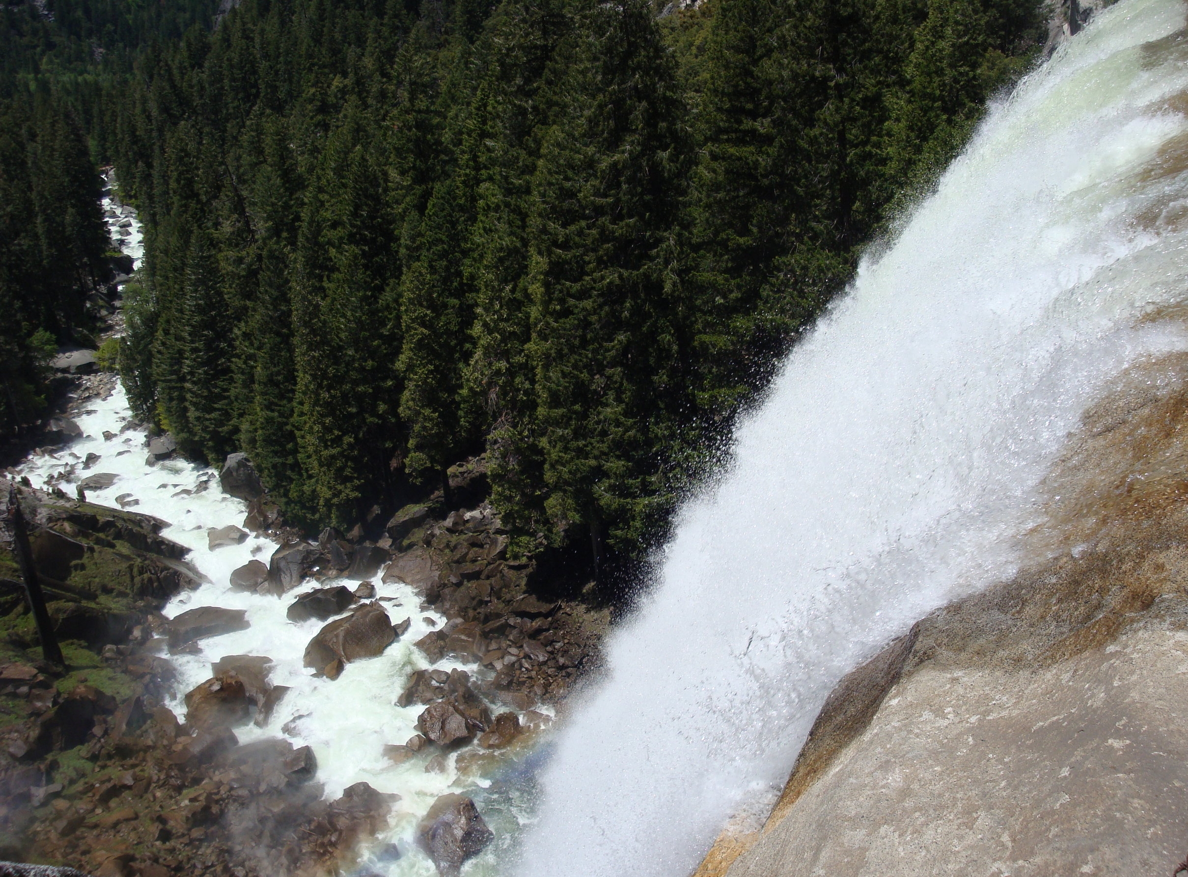
Nevada Fall
June 2017 - Nevada Fall as the Merced River plunges 594 ft on it way to Vernal Fall. Video taken from the Mist Trail.

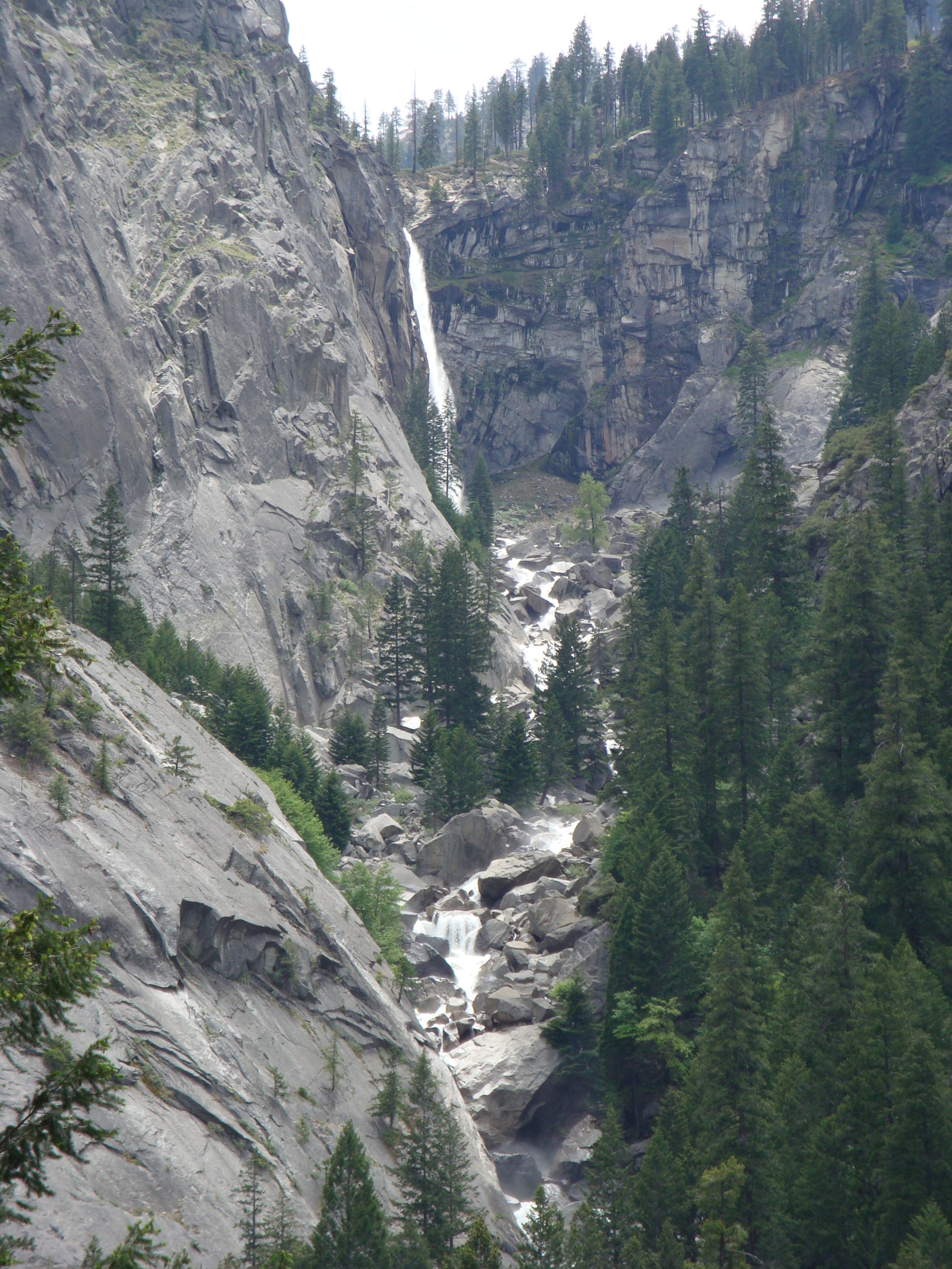
Nevada Fall
June 2008 - A view of Nevada Fall from below. Photo taken from the Mist Trail.
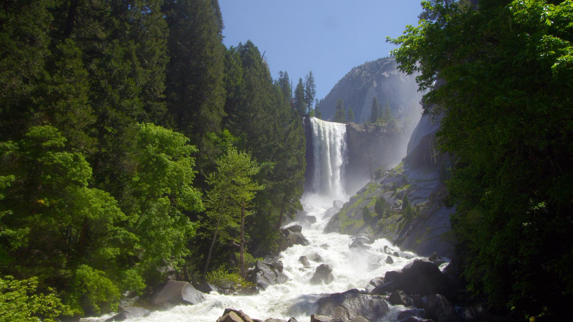
Vernal Fall
June 2008 - View from the top of Vernal Fall.

Vernal Fall
June 2008 - View of Vernal Fall from below from The Merced River and the Mist Trail.

Yosemite Valley
June 2008 - Yosemite Valley from the Tunnel view on CA41. This is how it looked before the 5-year drought.

Yosemite Valley
October 2016 - Yosemite Valley again from the Tunnel View. Notice the amount of dead pines from the drought and Pine Bark Beetle.

Chilnualna Falls Trail
May 2008 - A section of trail to Chilnualna Falls. Chilnualna Falls is a series of waterfalls totaling 690 feet on Chilnualna Creek. The hike is 8.2 miles (13.2 km) out and back with an uphill elevation change of 2100 feet (640 m). The best seasons for this hike are spring and early summer. This waterfall is as exciting as any in Yosemite valley, but few tourists know about it.

Chilnualna Falls
May 2008 - View from above of the main (or final) fall of Chilnualna Falls.

Chilnualna Falls
May 2008

The Bachelor and The Three Graces
May 2008 - Mariposa Grove of Giant Sequoias. The Grove has been closed in 2015 for renovation and opened again in June 2018. The National Park Service removed all the roads through the grove and eliminated vehicular traffic as it was causing damage to the trees root systems.

Half Dome and Clouds Rest
June 2008 - View of Half Dome and Clouds Rest from Sentinel Dome. The trail head for Sentinel Dome can be found off Glacier Point Road.

High Sierras
June 2008 - View of the high Sierras from Sentinel Dome.
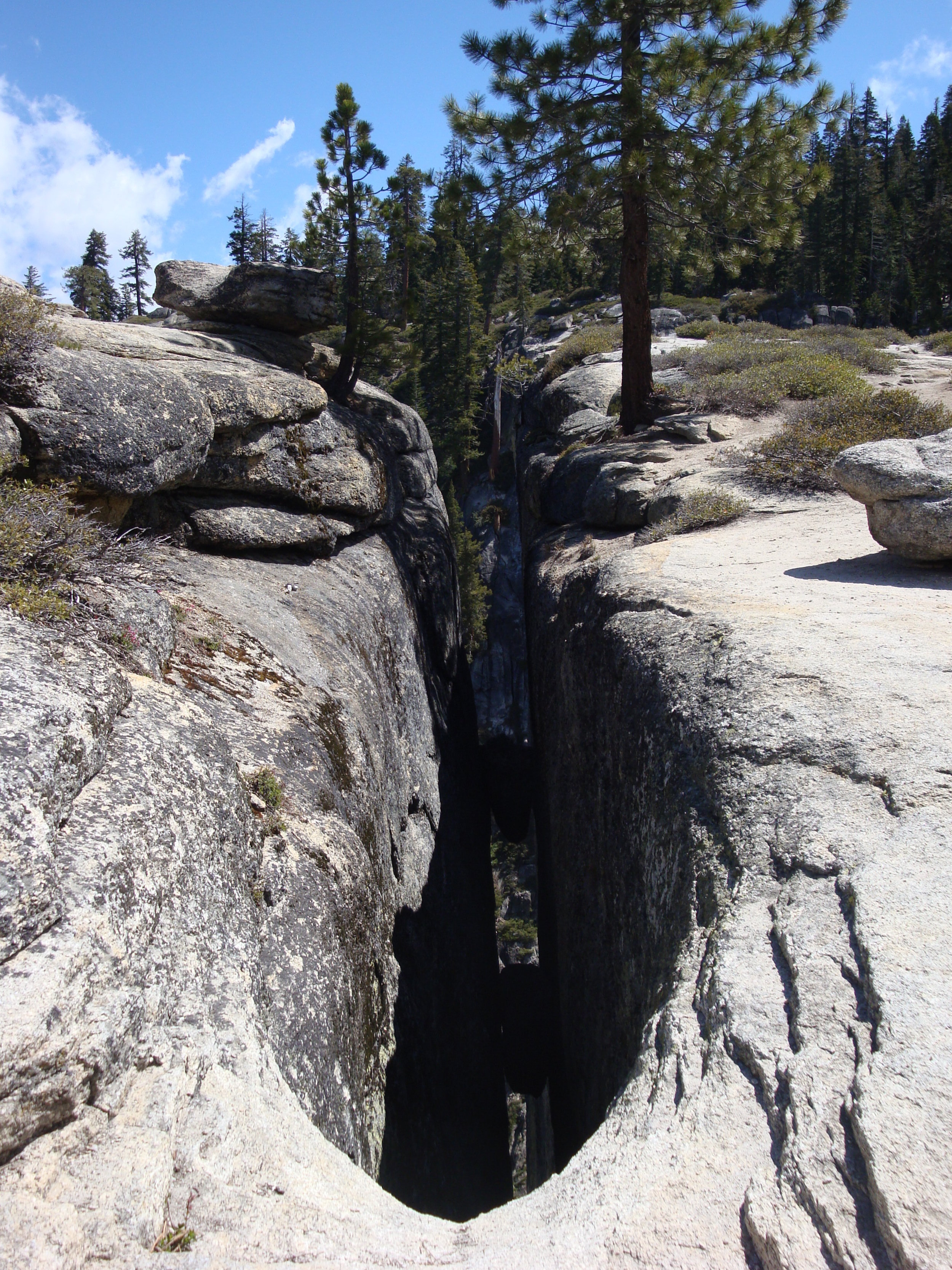
The Fissures
June 2008 - A view of one of the Fissures. The trail head for Taft Point and The Fissures can be found off Glacier Point road.

The Fissures
June 2008 - A view of another fissure. The fissures are breaks and cracks in the mountain that drop directly down to the valley floor at some points.

Taft Point
June 2008 - A view from Taft Point. Taft Point named after William Howard Taft is a viewpoint west of Glacier Point offering wide views of Yosemite Valley, Yosemite Falls, and El Capitan.

El Capitan
June 2008 - As viewed from Taft Point.
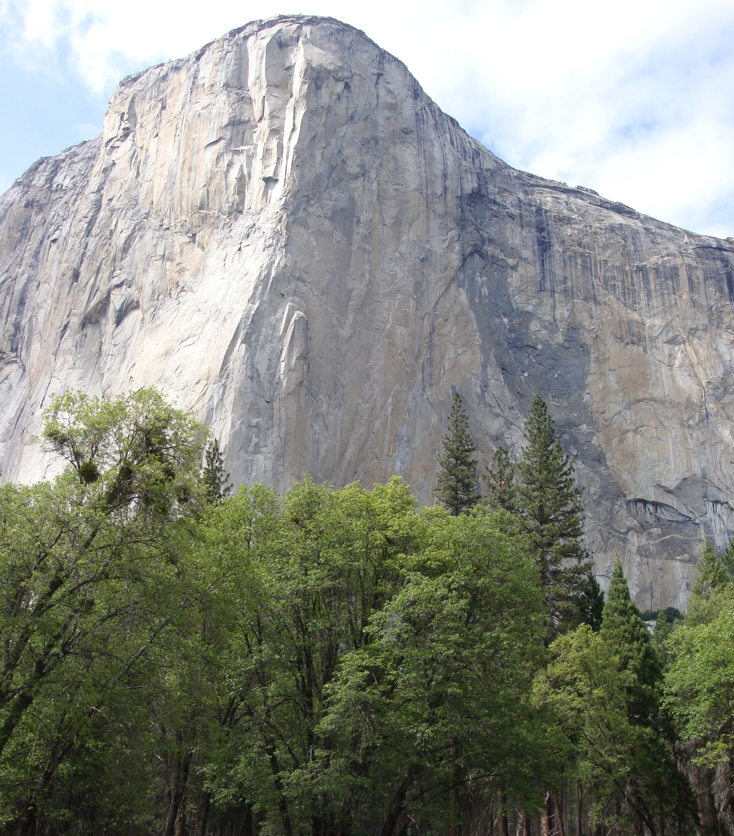
El Capitan
October 2016 - View of El Capitan from the Valley Floor.
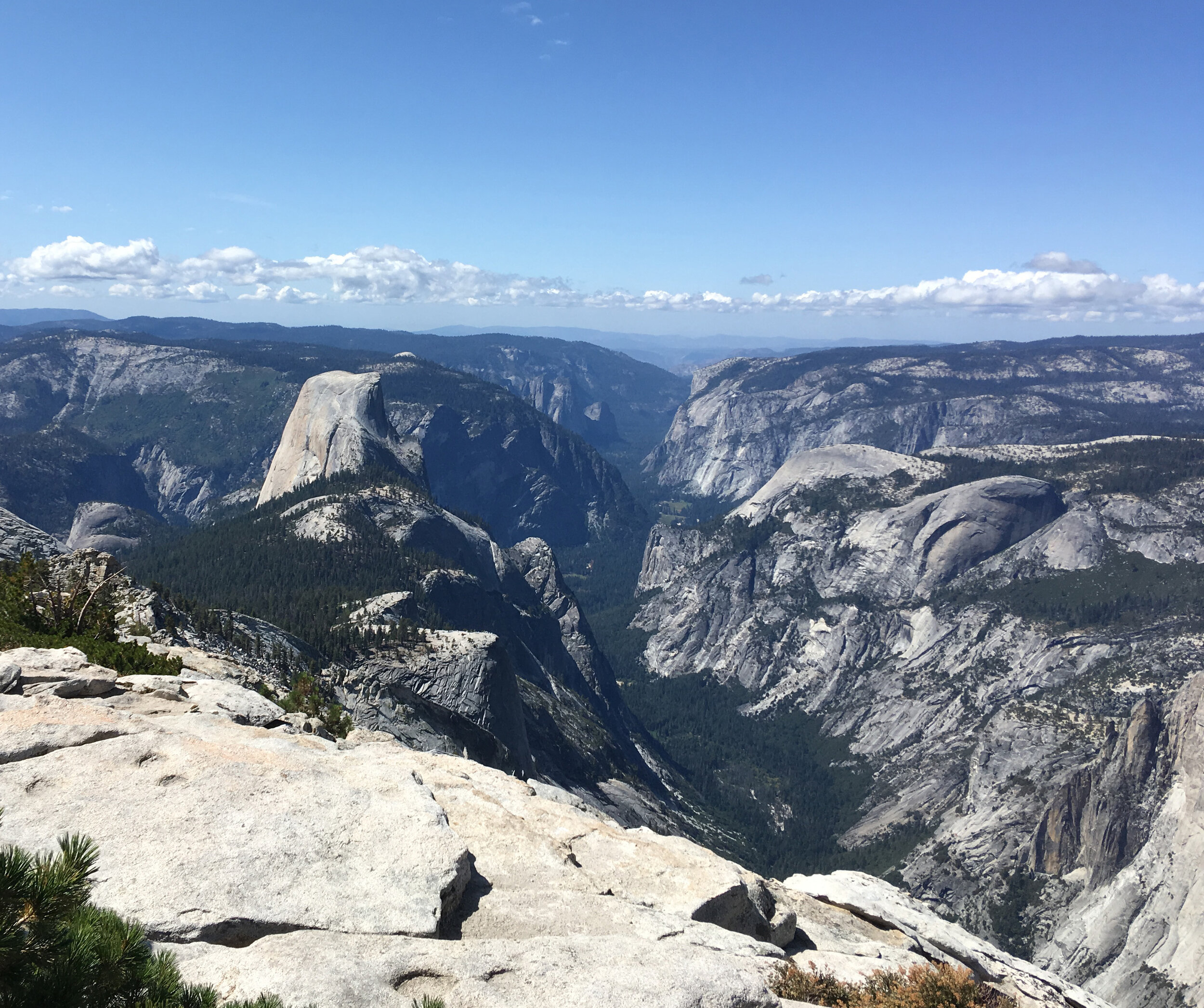
Half Dome and Yosemite Valley
September 2019 - As viewed from Clouds Rest. Glacier Point and Sentinel Dome are both visible in the background.

Clouds Rest
September 2019 - Final ascent to the top of Clouds Rest
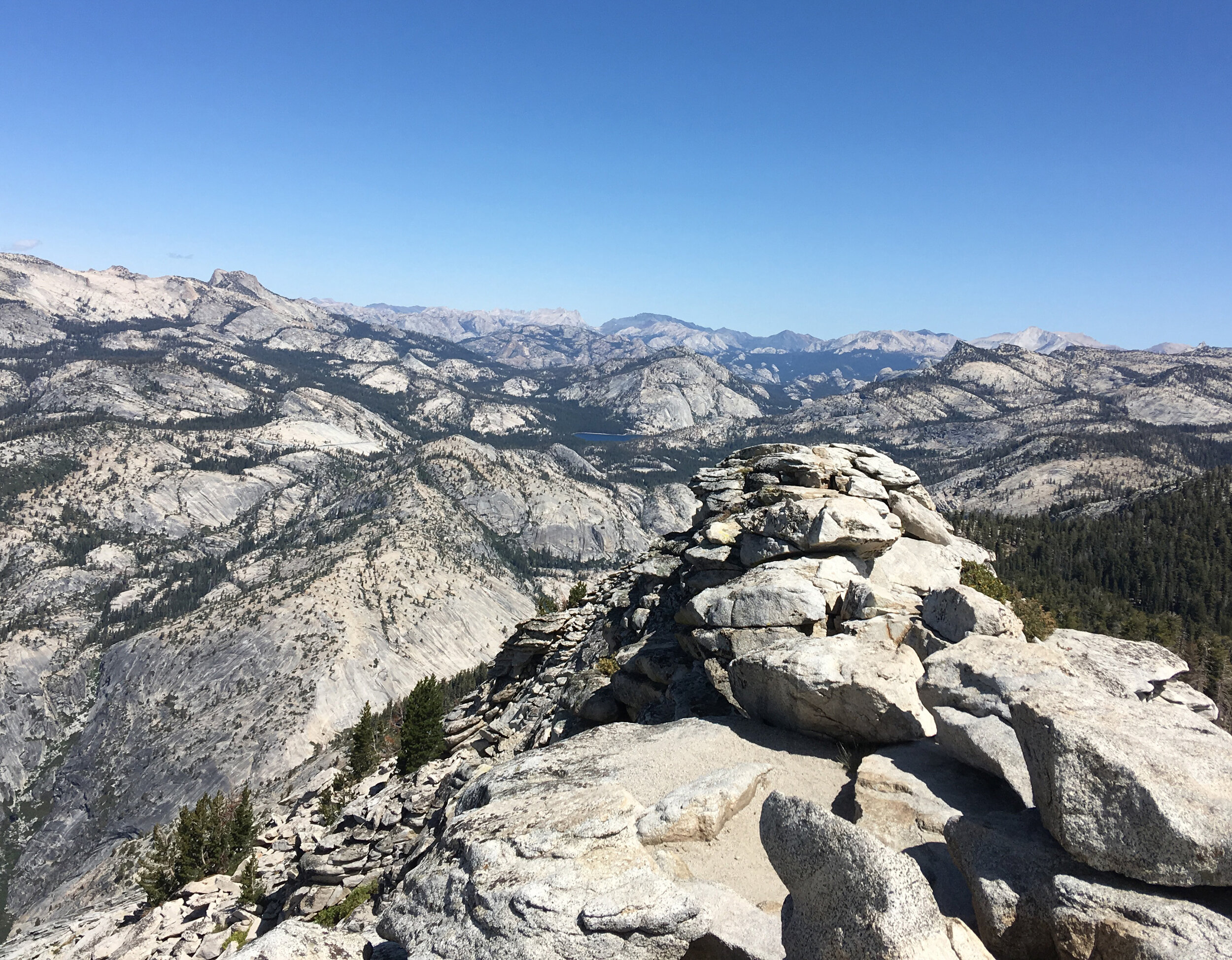
Clouds Rest
September 2019 - Looking back toward Tenaya Lake. In the foreground is the challenging portion of the Clouds Rest summit and not a place for someone with no head for heights.

Mount Hoffman
September 2019 - As viewed from the trail to Clouds Rest

Lembert Dome
July 2019 - The approach to the top of Lembert Dome. Tuolumne Meadows can be seen in the background

Dog Lake
July 2019 - As viewed after an early morning hike with no other visitors around

Dog Lake
July 2019 - With Mount Dana and Mount Gibbs in the background
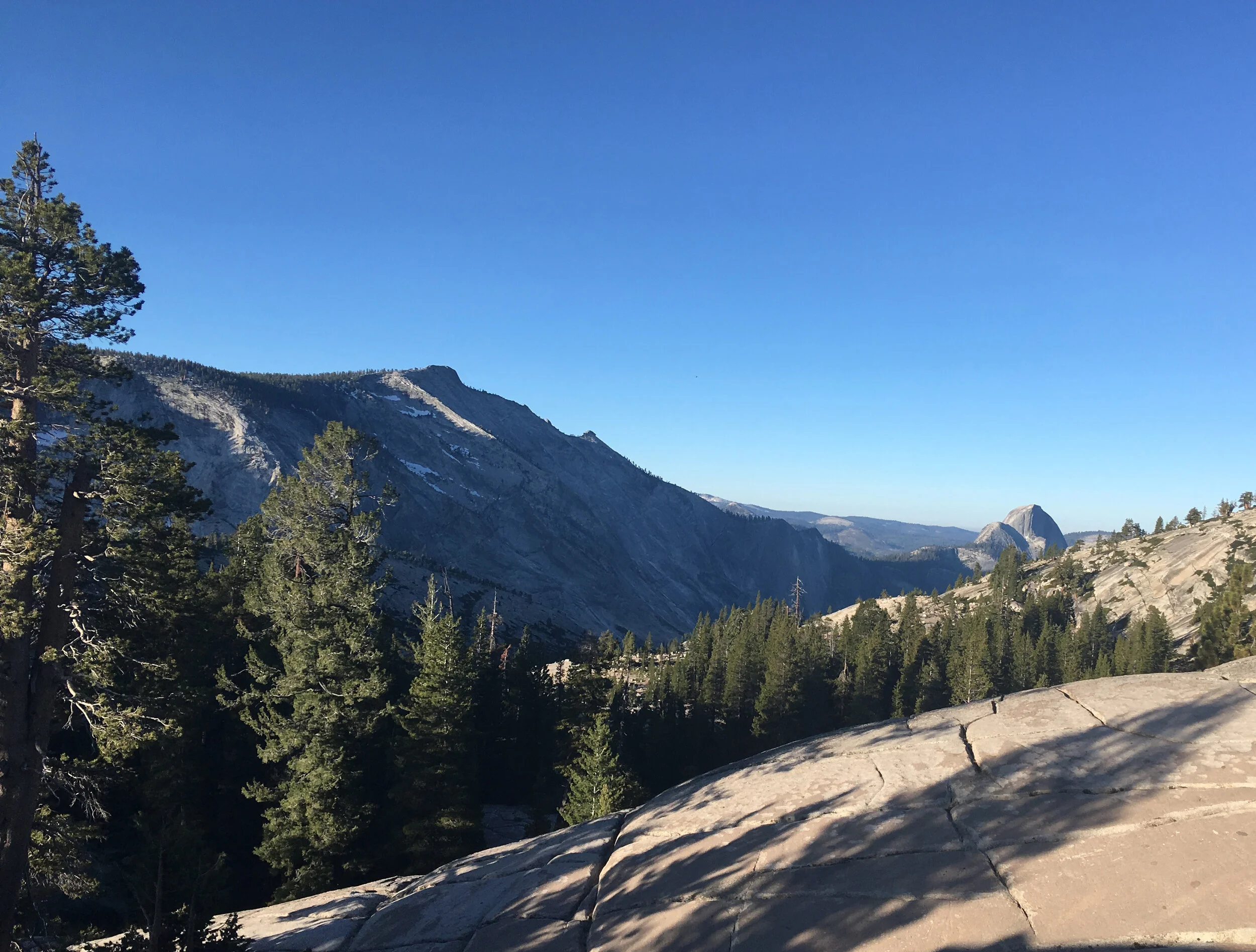
Clouds Rest and Half Dome
July 2019 - As viewed from Olmstead Point